
It hardly seemed fair. While researching information on hiking the McAfee Knob Trail near Roanoke, Virginia, I came across a calorie calculator that would estimate how many calories you would burn it you made this hike. Well, who can resist that? I plugged in my (real) weight, and got the result that I’d burn 1,260 calories. Then I plugged in my husband’s and it told me he would burn more than 2,000 calories doing the exact same hike. Once again, a man gets more credit for doing the same thing a woman is doing, right? But this was science, and there’s no fighting my body’s metabolism – believe me, I’ve tried for years. But burning calories is hardly the point of going on this beautiful hike. We were looking for exercise, a walk through the trees that were barely clinging to some of their fall foliage, and some fantastic scenery when we reached the spot that is the most photographed one on the Appalachian Trail.
I had researched the hike and got a bit confused about the two paths you could take to get to the top, so I copied directions onto my phone in case we got lost on the way. We found the parking lot easily enough, and lucky for us, even found a parking spot as I’d read the small lot often fills up quickly. We did not have a Plan B and parking on 311 is prohibited. Apparently there is a park and ride option in front of Orange Valley Market at the intersection of Route 419 & Route 311 if the lot is full.
To prepare for the hike we had packed a backpack with snacks and plenty of water. We were dressed in layers as the temperature was in the 40s. Unfortunately, neither of us could find out hiking boots as we packed for our trip, so we were wearing tennis shoes.
Starting the McAfee Knob Trail
To start the trail, we crossed over 311 carefully, as cars zoom by fairly fast on the curve so visibility for them is limited. Then we began to follow the white blazed trail as it slowly ascended through the wooded path. Not too far along our way the path angled sharply to the right and seemed to head back down the mountain. Common sense told us to continue straight as that way continued up the mountain, but when it comes to navigating we’ve learned the hard way that common sense isn’t always your best guide.
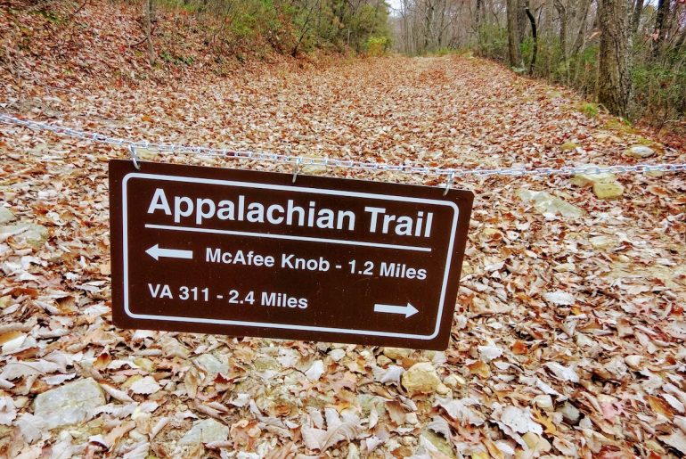
We stood there with another couple discussing the route when two gentlemen came strolling down the path, rhythmically swinging their walking sticks, which I took as signs they were avid hikers. We asked them about the trail and they told us they were on the fire road and if we wanted to stay on the Appalachian Trail, we did need to make that right turn.
“It’s a more rugged hike on the Appalachian Trail,” they said. “The fire road is nice as well because you have views on both sides of the ridgeline.”
We opted for the Appalachian Trail and continued on our way, keeping a fairly steady pace. Lucky for us the trail wasn’t too crowded, although I was surprised by several groups of runners coming towards us, many of them well over 50. The gradual elevation on the way up would be just one challenge for them – the extremely rocky path seemed the bigger one for me. One wrong step and your running days may be on hiatus for a while.
We only stopped briefly for a few water breaks. Once we took a seat on a log for a few minutes longer to eat a granola bar. A few hours into the hike, we came to the junction of the fire road and the Appalachian Trail.
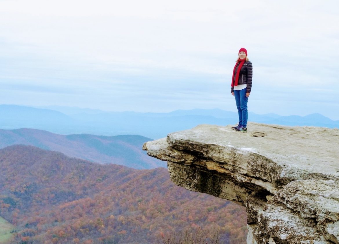
After two hours of hiking, I was ready to reach the summit, which we finally did after about two hours and 50 minutes. And we were not disappointed. McAfee Knob has about a 270-degree view of the Catawba Valley, Tinker Cliffs and Roanoke Valley. As reported, the stunning view was well worth the climb. After exploring the area a bit, we settled down on one of the many large rocks for a snack and a rest.
There were a few small groups at the top, which from what I’ve read can be really crowded at time. While you do have to wait your turn to get your photo taken on the most popular rock, we didn’t have to wait long and people are willing to move aside when they are done. While the photos of people hanging on the ledge look dramatic, it didn’t seem all that death-defying to me as the ground isn’t really that far below you.
Heading Back Down the McAfee Knob Trail
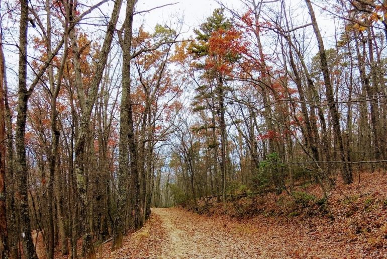
One our way back, we took the fire road, which was an easier walk down, and as promised had some beautiful views on both sides. We had left at 9:30 in the morning and got back shortly before two, for a total time of almost 4.5 hours. Of that we spent close to an hour on the top relaxing and taking photos.
I remembered to check my Fitbit in the parking lot when we returned and I had more than 22,974 steps. I may have had about 1,000 from that morning, so my best guess is that the total trip was around 22,000 steps for the trail. My Fitbit also registered 186 floors, setting a record for me.
It was a fantastic hike, one I’d recommend for everyone. And with the fire road, you have the option for an easier climb. While I wish I’d had my hiking boots, I did okay with my tennis shoes, although I slipped once on a rock. There had been a bit of rain so we had to step carefully in the wet spots.
As for the calories I burned, who knows? If you want to calculate how many you might burn, visit here.


1 Comment
Did the calorie calculator ask your gender? There may be gender related differences. Otherwise, calories burned are directly related to weight. You may find that the ratio of your calorie consumption to that of your husband is equal (or at least close to) the ratio of your weight to your husband’s weight.